UAS & Aerial Imagery
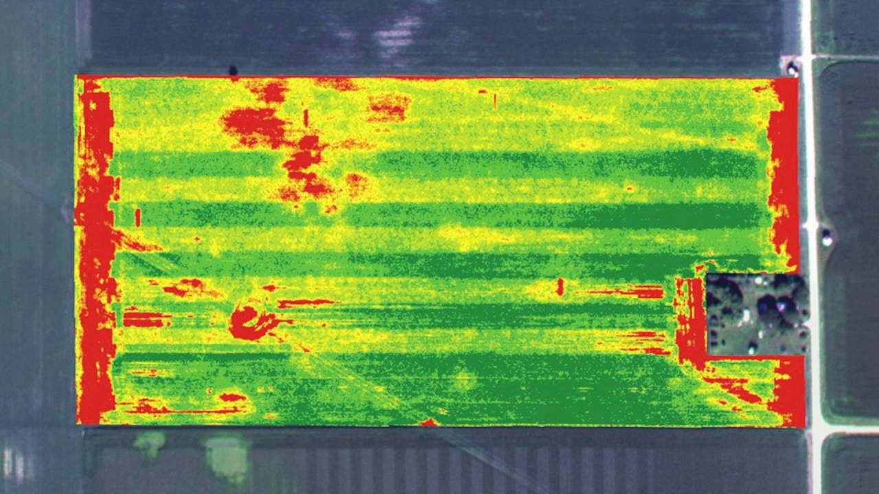
NDVI Crop Stress Mapping
What is NDVI?
Basically, it is a method of combining near infrared light with visual light into a photo. The result is the ability to “see” the amount of chlorophyll and moisture content in leaves which is an indication of the plant health.This is useful in determining if your crops are healthy or stressed early enough that you can do something about it before permanent damage occurs!
Looking across the field from the ground doesn’t always give you a complete picture of what is going on with your crop. An NDVI Crop Stress Map that is accurately Geo-referenced can help you scout your field more efficiently and effectively, so you can build in-season management plans based off the data it provides.
Implementation:
- Create management zones
- Anaylise effectiveness of fertilizer applications
- Precisely schedule irragation
- Schedule pesticide applications
- In-season anaylisis
- Find mechanical errors in application equipment.
- Early Emergence mapping
- Yield Estimation
- Variable Rate Prescription Maps
- Chemical drift investigation
- Crop Stress maps
Other Options:
Golf Course Mapping
Tax Assessment Mapping
Hunting Lease Mapping
Airport Mapping
Construction site Mapping
Real estate Mapping
Power line Inspection
Gas Line Inspection
Timber mapping
Waterway Mapping